Page 4
| The first step in producing a 3-D model from typically available survey data is to fill in the gaps between survey stations. I accomplish this by linearly interpreting between x,y,z coordinates calculated for the walls at each survey station. Though this provides the most accurate possible approximation of the 2-D conduit morphology, the map still doesn't reveal any information about conduit heights and depth changes. |
 |
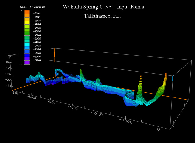 |
To make the jump to 3-D, a polygon is drawn around each survey station connecting the walls, to ceiling, and floor coordinates also determined from the survey data. Finally, one or more large data sets made up of all the x,y,z coordinates are constructed which contain all the points associated with the cave system being modeled. The slide on the left shows all the x,y,z coordinates used to calculate a 3-D model for A, K, and M tunnels in the Wakulla spring cave system of north Florida. |
Privacy Policy © 1998-2023 Global Underwater Explorers
