|
By Christopher Werner, GUE
Hydrogeololgist
INTRODUCTION
The WKP, developed in Leon, Wakulla, and Jefferson Counties,
Florida, is characterized by a thin veneer of unconsolidated and
undifferentiated Pleistocene quartz sand and shell beds, overlying
a thick sequence of relatively horizontal carbonates (Hendry and
Sproul, 1966). The WKP is a gently sloping topographic region of
low sand dunes and exposed carbonates rising from the Gulf of
Mexico to approximately 20 m in elevation within Leon County, the
northern terminus being the Cody scarp. The loosely consolidated
Pleistocene sands, being very porous and permeable, allow rapid
infiltration of precipitation. The St. Marks, Suwannee and Ocala
Limestones, underlying the unconsolidated sands, respectively,
comprise the Upper Floridan Aquifer System (FAS). These limestones,
being very porous, permeable and soluble, have undergone
considerable dissolution from groundwater movement (Hendry and
Sproul, 1966). As a result, the topography is karstic in nature,
with numerous sinkholes, karst windows, sinking streams, and large
springs (Rupert, 1988).
 |
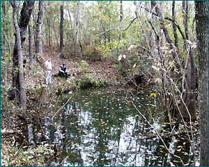
|
Cheryl Sink
|
Stratigraphy and
lithology of the Woodville Karst Plain (WKP)
The Miocene age sediments include the St. Marks Formation and
the Hawthorn Group. The Hawthorn Group is composed of several
formations and numerous members. It is primarily a clastic unit,
consisting of fine to medium grained sandy clays and silty, clayey
sands, with variable amounts of carbonate (Rupert, 1988). These are
usually interbedded and sometimes contain minor amounts of dolomite
and phosphate. Much of the Hawthorn has limited permeability and
acts as a confining unit north of the Cody scarp, called the
Tallahassee Hills.
The St. Marks sediments are predominately fine to medium fine
grained, partially recrystallized, silty to sandy limestones that
have undergone degrees of secondary dolomitization (Hendry and
Sproul, 1966). Within the WKP, the St. Marks Formation comprises
the top of the Upper FAS (Rupert, 1988). It also contains extensive
shallow conduits in portions of the Leon Sinks cave system and
Indian Springs cave. It pinches out against the Suwannee Limestone
in southwestern Jefferson County and reaches a maximum thickness of
approximately 60 m toward western Wakulla County.
 |
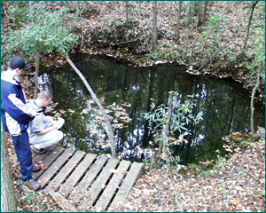
|
Sullivan
Sink
|
The Suwannee Limestone of the Oligocene reaches a maximum
thickness of 160 m at approximately 30 m to 150 m below the land
surface within Leon and Wakulla Counties (Davis, 1996). The
thickest portion of the Suwannee is found south of Tallahassee at
the Gulf of Mexico and the thinnest located near the Georgia border
(Hendry and Sproul, 1966). It consists of two types of permeable
rock; (1) a crystalline tan, highly fossiliferous limestone and (2)
a white to cream, finely crystalline limestone containing
foraminifera with micritic limestone pellets (Davis, 1996). The
Suwannee limestone is the principal lithology transporting much of
the groundwater of the Upper FAS within the WKP. The majority of
dissolution conduits within the WKP are primarily developed in the
Suwannee limestone.
The regional structure of the area surrounding the WKP has four
major components: (1) the Apalachicola Embayment, (2) the Gulf
Trough in southwestern Georgia, (3) the Peninsular Arch, and (4)
the Ocala Uplift. These four features have provided the necessary
conditions precluding the initiation of karst conduit development
in the WKP.
The Apalachicola Embayment, sometimes referred to as the
Southwest Georgia Embayment, and located west of the WKP, is a
southwest-plunging syncline containing a thick sequence of
predominantly clastic material (Miller, 1986). It is thought that
this feature is the middle Mesozoic to middle Cenozoic depositional
basin of the Apalachicola River (Schmidt, 1984). In some instances,
carbonate deposition spilled westward from the Florida platform
into the embayment. The region has continued to subside and the
downwarping of sediments are observed, as well as the thickening of
Ocala, Suwannee, and St. Marks limestones to the west from the
WKP.
The Gulf Trough is a series of northeast-trending faults that
bound a series of small grabens (Miller, 1986). These grabens are
primarily low permeability clastic rocks which have been
down-dropped on either side opposite the thick sequence of
carbonates. These fault bounded, down-dropped blocks have the
effect of retarding the flow of groundwater from the north within
the FAS (Miller, 1986).
The Peninsular Arch is a northwest-trending feature that was
continually positive from Jurassic until Late Cretaceous time
(Miller, 1986). It may have also been sporadically positive during
the Cenozoic also. The effect of this feature has been to control
sedimentation in north-central Florida and has been proposed to be
a result of compressional tectonics (Miller, 1986).
The Ocala Uplift is another northwest-trending uplift
paralleling the Peninsular Arch to the west. The Ocala Uplift only
effects sediments of middle Eocene and younger, and is thought to
be a buildup of Eocene carbonate sediments, or more likely, a
compaction of Eocene material after deposition (Miller, 1986).
The regional structural features of the Apalachicola Embayment
and the Peninsular Arch bounding the WKP have been influential in
its history by setting the stage for deposition of carbonates
following in time. The Eocene compaction of sediments from the
Ocala uplift and the fault bounded down-dropped blocks of the Gulf
Trough have been the regional structural controls responsible for
creating the current exposure of Miocene and Oligocene carbonates
seen at the surface. These structural manifestations have allowed
the overlying sediments of the Hawthorn Group within the WKP to be
subjected to physical and chemical erosion from the Gulf shoreline
during the Quaternary. These influences have culminated in the
proper geologic setting conducive to karst conduit formation.
Regional hydrology
encompassing the WKP
The regional aquifer system is divided into two distinct water
bearing units, the surficial aquifer and the FAS. In most places
surrounding the WKP, low permeability rocks of the upper confining
unit of the Floridan, separate the surficial and FAS. The upper
confining unit is comprised of consistently low permeability
clastic rocks. The surficial aquifer is usually comprised of poorly
consolidated to unconsolidated clastic rocks and sediments where
water typically occurs in unconfined conditions (Miller, 1986). The
upper confining unit is absent within the WKP. The Upper FAS
includes Tertiary carbonates formed during the Oligocene and
Miocene Series and is overlain by deposits from the Pliocene,
Pleistocene and Holocene (Hendry and Sproul, 1966). Specifically
within the WKP, the Upper FAS is comprised of the St. Marks,
Suwannee, and Ocala limestones.
 |
|
Wakulla Springs
Cavern Zone
|
The regional recharge area for WKP extends north of the Georgia
border for over 80 km and covers portions of over five Georgia
Counties (Davis, 1996). The regional groundwater flow pattern,
taken from piezometric contour maps, shows overall south trending
flow lines (Davis, 1996). There is an interesting feature of the
piezometric contour maps which show a saddle or potentiometric low
area extending well into the WKP. This causes a convergent flow
line pattern toward the southern-central area of the karst plain.
In this area, there are several major first-order magnitude springs
including Wakulla Springs, the St. Marks Spring Group, Spring Creek
Spring, and Wacissa Springs. This regional convergence of flow is
thought to originate from the fact that the WKP confining unit is
absent. Thus flow through Leon county, being confined by the
Miccosukee and Hawthorn Formations, converges in the WKP, where the
lack of these confining units allows groundwater mass transport to
result in artesian flow at the surface.
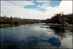 |
|
Wakulla River,
from the head spring
|
Most groundwater circulation is thought to take place within the
Upper FAS (Miller, 1986). The groundwater within the Upper FAS is
also less mineralized than that of the Lower FAS (Sprinkle, 1985),
and hence is regarded as such because of vigorous circulation. This
circulation is believed to be the result of high moldic and
intergranular porosity, as well as secondary dissolution (Miller,
1986). This however, does not indicate that there is not deep
circulation or mixing of groundwater from the Lower FAS. In places,
there may be a mechanism for transporting older deeper water up
into the Upper FAS by means of a reduced pressure head.
Local hydrology of the WKP
There are several extensive underwater cave systems developed
within the WKP due to dissolution, which is evident through the
related karst topography. These cave systems extend over several
kilometers and are limited by depths not exceeding 100 m. There
exists several distinct levels of conduit development at various
depths below mean sea level. These passage levels may have been
formed due to preferential groundwater flow at certain levels.
As stated earlier, the loosely consolidated sands, being very
porous and permeable, allow rapid infiltration of precipitation.
Likewise there are a few surface stream, which dive below land
surface upon entering the WKP. Some streams are intermittent, with
the ability to transport water only when the infiltration rate is
exceeded and surface runoff is initiated through excessive
precipitation with respect to volume and/or time. In some places
within the Leon Sinks Geological Site, groundwater emerges and
flows in a surface stream and then, within a few tens of meters,
sinks below ground once again.
The Upper FAS has very high transmissivity rates, due to the
high permeability and porosity of these limestones, and is the
principal member in local groundwater flow. Much of the drainage is
subsurface, within the WKP, through large open conduits, developed
in the St. Marks and Suwannee Limestones. Cave divers of the
Woodville Karst Plain Project (WKPP), have conducted surveys of
many of the underwater conduits establishing the existence of a
large network of interconnecting passages. Over 33.5 km of surveyed
passage has been mapped to date. Approximately 22.8 km of passage
have been connected to establish the Leon Sinks Cave System
(Irving, 1996), the largest and deepest underwater cave system
within the United States.
Maps and surveys were obtained from Irving (1996), and a
detailed preliminary analysis was conducted of the Leon Sinks cave
system, as well as Indian Spring, Sally Ward Spring, Chips Hole,
Shepard Spring and Wakulla Springs cave systems. It was apparent
very early from the maps, that the caves of the WKP exhibited
multiple drainage lines and these passages appeared to be tiered.
The passage lengths were calculated and totaled at certain mean
depths below sea level. These corresponding depths were grouped at
approximately three meter intervals.
 |
|
Wakulla
Springs
|
It was readily apparent these conduits could be grouped into
several distinct levels. The levels were named A through E and
given an appropriate range of approximate depths. The passage
levels shown to exhibit the most prominent development within the
WKP were as follows:
| Level |
Passage level depth in meters below mean
sea level |
Percent of total passage
length |
| A |
-12.0 to -18.0 |
9.2 |
| B |
~ -24.0 |
6.8 |
| C |
-30.0 to -36.0 |
10.1 |
| D |
-52.0 to -64.0 |
31.7 |
| E |
-79.0 to -85.0 |
31.9 |
It is important to notice that levels A through C could be
grouped as a single level but were not because of the differing
cave systems in which they are located and the level itself would
be within a range of over 25 m. There does appear to be some local
variations in the shallow levels, which would constituent
separating these into three distinct levels, involving localized
drainage basins within the WKP.
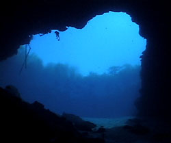
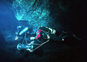
 |
|
WKP Conduit
|
The morphology of the cave systems within the WKP suggest a
tiered, multiple line drainage pattern, which has been documented
in the Mammoth-Flint Ridge cave system of Kentucky (Palmer, 1981).
The effect of base level fluctuations are obviously more complex
than a simple downcutting fluvial system. With further
investigation, it should be possible to ascertain the paleodrainage
of the WKP cave systems. The degree of structural and lithologic
control on a local level must also be ascertained to provide a
complete overview of the hydrogeologic regime within the WKP.
- Davis, H., 1996, Hydrogeologic Investigation and Simulation of
Ground-Water Flow in the Upper Floridan Aquifer of North-Central
Florida and Delineation of Contributing Areas for Selected City of
Tallahassee, Florida, Water Supply Wells: USGS Water-Resources
Investigation Report 95-4296.
- Hendry, C. W., and Sproul, C. R., 1966, Geology and groundwater
resources of Leon County, Florida: Florida Geologic Survey Bulletin
47.
- Irving, Steve, 1996, Woodville Karst Plain Project, personal
communication.
- Miller, James A., 1986, hydrologic framework of the Floridan
aquifer system in Florida and in parts of Georgia, Alabama and
South Carolina: U. S. Geologic Survey Professional Paper
1403-B.
- Palmer, A. N., 1981, A geological guide to Mammoth Cave
National Park, Zephyrus Press, Teaneck, NJ.
- Rupert, Frank, 1988, Geology of Wakulla County, Florida:
Florida Geologic Survey Bulletin 60.
- Schmidt, W., 1984, Neogene stratigraphy and geologic history of
the Apalachicola Embayment, Florida: Florida Geological Survey
Bulletin 58.
- Sprinkle, C. L., 1985, Geochemistry of the Floridan aquifer
system in Florida and in parts of Georgia, South Carolina, and
Alabama: U. S. Geologic Survey Professional Paper 1403-I.
|
